Wednesday, May 28, 2008

HAB’s hit the area HARD…


This spring has brought unwelcome visitors to the area. Harmful Algae Blooms! Our old friend and archenemy of eelgrass and shellfish, the “Brown Tide” (Aureococcus anophagefferens), has hit Great South Bay hard and is creeping east at an alarming rate. Another species, nicknamed the “Mahogany Tide” (Prorocentrum minimum) (see photos) has also been sighted in local waters. First time I’ve heard of that one. What is happening?

Fortunately we are in capable hands as Robert “Mac” Waters, Supervisor for the Suffolk County Department of Health Services, Bureau of Marine Resources has been sending out almost daily email alerts detailing the geographic spread and intensity of the bloom as his team tracks the invasion.

This has already caused the cancellation of a long overdue NYSDOS-sponsored aerial mapping effort for eelgrass in the SSER where you can’t see the bottom and the Peconics for logistical reasons. In addition, we had planned to follow up on a seeding project we conducted at the Blue Points Property owned by TNC, but this was also scrubbed given the nonexistent vis.

My main concern at this time is two-fold. First, how far into Shinnecock Bay will the BT spread? We have plans to work in western parts of the bay this year, but that will likely be on hold for now. What about the eastern half though? Will it move east of the canal? Also, if it does move into the eastern part of the bay will it pass north through the Shinnecock Canal and into the Peconic Estuary? That would really be a bummer…our Red Cedar Bluff site, that is doing so well, is very close to the canal.

At this point all we can do is sit back and let the SCDHS do their job. Every day we watch the numbers come in like some defeated general getting casualty reports from the field. Hopefully, this will end some time soon. If not, we could lose even more eelgrass.

I’m just glad that BT doesn’t bloom in Long Island Sound….yet!
PHOTOS TAKEN BY PHIL DeBLASI, SCDHS

-ChrisP

Friday, May 23, 2008

The Perfect Storm: September 11th 2007


Last fall during a heaving storm we lost much of what was one of the most incredible meadows in the Peconic Estuary. We are used to seeing meadows in the PE slowly wither over time as multiple stressors take their toll and they get smaller and smaller and smaller until they reach a point of no return and don’t come back the next year. In the last 15 years this has happened in Southold Bay, Northwest Harbor, Orient Harbor and many other sites I would rather not mention...

The Orient Point meadow was different though. This large meadow located in the cool clear waters near Plum Gut was one of our favorites and it showed no signs of stress or the slightest inkling of a problem, because up until September 2007, there was no problem.

For almost 10 years we have marveled at this site. From a practical point of view it was easily accessible by boat or truck and provided us with an endless supply of naturally uprooted shoots for transplant stock or seeds for our seeding efforts. In both cases we couldn’t collect 1% of what was available so we were confident that we were not having an impact. Our monthly dives here confirmed this.

Then came September 11th 2007… From my office window at Cedar beach in Southold, 12 miles west, which just happens to share the same exposure as Orient Point, I could see that it was bad, but I didn’t know how bad. I did take note of the fact that the wind never seemed to stop and the waves were crashing on our beach for almost two whole days.

But eventually as it always does, the storm stopped and we got back to the routine field work or early fall, collecting shoots and stockpiling them in our greenhouse for the upcoming restoration season. Everything was good, or so we thought…

It wasn’t until October 16th, when we happened to visit Orient on one of our regular shoot collection missions that we realized something was wrong, very wrong. Steve and Kim had gone out as they often do, but this time the report back was that not only were there no shoots to collect, but even worse, the meadow had vanished! The bottom was naked and only a few plants remained where previously there were more than 500 in a square meter.

When I got the news I was in disbelief. How could this be? What happened? Eventually, I thought about the storm we had in September and pieced together the timeline based on our dive logs. We had been to the site on September 1st and there was NO sign of anything wrong.

A search through the NOAA weather buoy archives provided the proof that I needed. A perfect storm of wind direction, intensity and duration had started on September 11th and ran into the 13th. Average seas in the area were 3-4’ over an 18hr period! Somehow the wind had passes south of Plum Island and north of the Gardiners Island ruins hitting Orient at an oblique angle that proved devastating.

My first dive on the site was on October 18th. When I dropped in I was shocked at what I saw. It looked like someone had come along and cut off all of the shoots, especially in the middle to deeper areas. Despite this devastation I was able to pick out some clues that told the story. One interesting observation was the fact that the rhizome mat was still intact throughout the meadow so the storm was not violent enough to rip the plants out entirely. What appears to have happen was even more bizarre. As I looked closely at what remained I found that the terminal ends of the rhizomes (where the shoot had once been attached) were frayed and rotting. This led me to the conclusion that the waves had actually taken the leaves and either rocked them back and forth and/or twisted them to the point where they simply broke off.

On a more positive note, there were still small clumps of plants next to larger rocks that apparently afforded some protection. Even more surprising was the fact that the inner, shallowest edge appeared to weather the storm better than the deeper areas. I must admit that this part did not make sense. The fact that the rhizome mat and most of the sediments were still there also means that there was the potential for seedling recruitment.

What is the fate of the Orient Point meadow? Is it lost forever? Will it recover?

In a future post I will describe subsequent observations at this site and a project we have recently initiated to track what we hope will be natural recovery over the coming years. As the old saying in ecology goes: “Mother Nature abhors a vacuum”; I just hope she fills it with eelgrass and not algae in this case!

-ChrisP

Wednesday, May 21, 2008

Overcoming muddy sediments?


As I have noted in several previous blogs we have observed that the grass in most of our muddy bottom creeks and harbors around Long Island has disappeared. There are many theories as to why this happened, but on the top of the list is the stress associated with growing in muddy, highly organic, anoxic (lack of oxygen) sediments.

One theory is that low light and/or high water temperatures (or some other stressor) combined with sediment anoxia kills the plants by poisoning the meristem. This appears to have a significant impact on young seedlings.

Sulfide toxicity has been held out as the main culprit in this scenario. The problem is how can we control sulfur concentrations in the marine environment? The answer is we probably can’t since sulfur is everywhere!

One way around this may be to somehow alter the sediment is such a way that it does not go completely anoxic. This might be achieved by lowering the amount of organic matter and/or increasing sediment texture (from silts to sands). Since lowering organic matter is nearly impossible we have considered changing the texture by adding a thin layer of sand to the surface of the mud. In theory, this should allow oxygen to penetrate the surface sediments and prevent sulfide build-up at the base of the shoot.

We decided to try this out at Noyack Creek in Southampton where we already have a large number of seedlings that resulted form last year’s restoration work. Over the last couple days we set out 30 small tubes isolating individual seedlings on the bottom. The experiment involves doing nothing to the seedling (control) or either adding 1cm or 2.5cm of sand to the surface of the sediment surrounding the seedling. The hope is that we will see a difference in survival and growth between these three treatments in the coming weeks.

At this time all the seedlings look great and there is no sign of stress whatsoever. However, we observed a similar thing a few years ago when thousands of natural seedlings recruited to this site. That year the seedlings looked great during May and early June, but by the end of June they were ALL dead.

We’ll keep checking on our seedlings weekly to see what happens over the next two months. It would be nice if everything survives, but I must admit that I might be more pleased if only the sand treatments survive.

-ChrisP

Monday, May 19, 2008

Eyes in the sky...


It is not that often that you get a chance to do research from a helicopter. So, when I got the call that a local businessman offered to donate a nice block of flight hours in his new turbine-powered helicopter and personally fly us around the East End to do some seagrass survey work, you didn’t have to ask me twice. My answer was “Great, when can we start!” Luckily, the reply was “What are you doing tomorrow afternoon?”

The effort has been tentatively called “Flying LEAP” for the Long-island Eelgrass Assessment Program…our businessman-pilot is used to dealing with the military, so a catchy acronym is a must.

Although everyone knows that aerial surveys are THE way to go when trying to map and run trends analysis data for eelgrass meadows the lack of public dollars and bureaucratic momentum means that this is often not possible. In this day of satellite imagery and every other new fangled means of remote sensing you would think it could be done form our desk. Maybe it can if you are with the US Defense Department but for us lowly civilians it’s just not going to happen.

Take the Peconic Estuary as an example. We were involved with a fixed wing aerial survey and ground truthing effort dating back to 2001. This was the first and last time this was done for the region; pitiful, but true. Now Google Earth and Microsoft Live Search Maps make things a little easier, but there is only so much you can do with existing photo sets which were clearly not acquired for the purposes of mapping seagrasses. I’m not complaining mind you, just stating a fact.

If we could go where we want, when we want (times of good water clarity, low tide, low wind and low sun angle) then we can really capture some great images. This is where our friend and his helicopter come in…

Over the last couple weeks we have been running flights over various parts of the Island, photographing existing meadows, current restoration sites and scouting for new restoration sites. We typically run with three cameras, one video and two still in most cases, to catch all the action. Through this effort we have found entirely new areas of grass that were unknown to us as well as gotten a “bird’s eye view” of our restoration sites around the Island. There is no substitute for seeing the grass from above with your own eyes.

Our flights over Shinnecock and Moriches Bays were especially productive as we had an absolutely PERFECT day with a low tide, no wind and great water clarity. It seemed like we could almost see fish in the grass. We are excited to follow up on these observations and get out in a boat and visit some of these interesting areas.

It is hoped that we can continue this work into the summer and fall, especially when the water is clear. We have already learned so much and would like to continue…plus, it beats any day in the office!

Thanks again, friend, and fly safe!

-ChrisP

Other LIS sites to report on...


I didn’t get a chance to finish reporting on the other two sites we visited during our May 14th Long Island Sound dive trip so here you go. Given the high cost of fuel, we always try and hit as many sites as we can on the same day and these are the last two.

Mulford Point is a site that we always check for a number of reasons. This is a large meadow where we often collect naturally uprooted shoots for use as transplants in our restoration work. Luckily, we don’t have to always have to go by boat as there is convenient land access where we can get a truck relatively close to shore and unload our gear.

Since Steve and Kim went in, I didn’t get a look at this site first hand, but I was happy that they reported that there were lots of loose shoots at the inshore edge of both the inner and outer bands of grass. We will be scheduling a collection date to coincide with plantings at one of our restoration sites, most likely Caumsett State Park in Huntington.

Later in the season (August) Steve and Kim will visit 6 permanent monitoring stations established at Mulford to track trends in shoot density and percent cover. This work is essential in helping us understand how LIS meadows function and it also helps us make sure that we are not impacting the donor site through our collection process.

It was also interesting to note that Steve found several plants that were heavily coated with snail eggs. The apparent culprit was the Threeline Mudsnail/New England Dog Whelk (Ilyanassa trivittata) found on the plants, but the eggs sure looked like they came from Eastern Mudsnails. This is the only site where we have observed the Dog Whelks, although they must occur at other sites. We usually see them rooting for food around the base of the shoots. I am always surprised at how fast they move and how aggressive they appear to be. Can the word “aggressive” ever be used to describe a snail?

Our final stop on this trip was a visit to our test plantings at Great Gull Island, just east of Plum Island. We planted shoots gathered from Fishers Island here a couple years ago and are happy to report that the plants are thriving. The water is deep and the wave energy is high, but the plants have really filled in despite the small number of shoots that were originally planted. As is typical for this site, seals were seen swimming at the surface, but we didn’t see any during our dive. Some day I hope to see them face to face…

-ChrisP

Friday, May 16, 2008

In Search of Seepage…


Yesterday found us out on the Peconic Bay looking for groundwater seepage sites. This work is part of a NYS funded project where we are looking to determine the impact (good, bad or nothing) of subsurface groundwater seepage on the growth of eelgrass.

The research team includes my crew who will be responsible for all plantings, Chris Smith (CCE) and Ron Paulsen (Suffolk County) working on the seepage and Brad Peterson (SUNY Southampton) who will be conducting field and laboratory work to determine the effects of the seepage on the plants.

I am coming at this from the point of view that cold groundwater upwelling out of the sediments could be a good thing if it keeps the base of the plant and the meristem cool in August. Brad is approaching it more from the point of view that all the contaminants that Ron and his crew have been finding including several herbicides and their derivatives may be toxic to eelgrass preventing it from thriving if not outright killing it…

In order to test both theories we have chosen three sites running the range of clean to highly contaminated groundwater. The “clean” site is located off the east side of Jessup’s Neck and the “contaminated” site is in Laurel just east of the Riverhead/Southold town line. A site with unknown water quality (Cold Spring Pond in Southampton) was also chosen based on our observations that there is lots of upwelling happening there. There had to be some reason for the name!

Yesterday proved to be a productive if not a little frustrating day. We were able to find plenty of seepage areas, but the non-seepage "control" sites still elude us at the locations chosen. We may have to come up with another way to artificially control the seepage so we can plant in the same general areas and run a valid experiment.

Another bummer was me cutting my thumb somewhere on the boat (ouch!). I don’t know where it happened, but there sure was blood all over. Good thing we always carry a first aid kit!

I’m looking forward to hearing back form Ron about the data we collected to find out if we found the right spots. If we got it right the plantings will take place soon…

-ChrisP

Wednesday, May 14, 2008

Terry’s Point keeps expanding...


Another dive we look forward to each spring is our Terry’s Point restoration site in Long Island Sound. This National Fish and Wildlife Foundation (NFWF) funded project is about 1.5 miles east of our largest restoration site, St. Thomas Point. Both sites are in Southold.

The Terry’s Point project began as a test planting site in our first NFWF grant and has developed into a large-scale restoration project. Our first work here involved transplanting 500 shoots in June 2005 followed by 500 shoots in August 2005. The August shoots eventually all died for a number of reasons, while the June shoots survived and grew from 500 to 4,500 shoots by September of 2006. Not too bad! This growth even exceeds what we have seen at St. Thomas Point where it is deeper, the exposure is a little different and we tend to get more erosion.

Today’s dive at Terry’s proved that the site is still doing well and densities are extremely high. We haven’t measured shoot density here in almost two years, but I am sure that it is higher than St. Thomas just by their appearance. We will have to bring out a couple quadrats and count shoots soon.

One major difference observed today between the two sites was the snail (Lacuna vincta) community. I described the snails at St. Thomas in my last post. The snails at Terry’s were much larger and easier to see; some were even laying eggs. The very small snails were also there like St. Thomas, but the adults were much easier to find. There was also a difference in the number of egg masses with the Terry’s egg masses reaching densities I have never witnessed (above left).

I look forward to getting back to this site soon to add some more plantings, measure shoot density and check on the snails. I am very interested to know if it really is higher than St. Thomas as it appears to be…

-ChrisP

The first dive at the St. Thomas Point


It is always nice to dive on our most successful restoration site, St. Thomas Point in Southold, and we finally got to do that today. This National Fish and Wildlife Foundation funded project is one of our favorites for obvious reasons.

Unfortunately, boat issues have plagued us early this spring and we are a little behind in our normal Long Island Sound rounds. Today we played a little “catch up” and hit a few sites including St. Thomas. Usually, we would have visited this site some time in late April, but this year, May 14th will have to suffice.

As usual, the site looked great. Even though we’ve been working here for nearly 5 years it is still hard to believe that this is a restoration site and all the plants were either planted by us or spread as a result of our work. Every year the meadow looks more like the natural reference meadow located 4 miles to the east at Mulford Point. Today this was most obvious at the eroded inshore edge which looked very similar to what we see at Mulford. Apparently, the noreaster that was hanging around for the last couple of days moved around a lot of sand. It didn’t seem to harm the plants, but the evidence was there in the form of exposed roots, rhizomes and cobble that is normally covered by a few cm of sand.

I have no doubt that some of the shallowest patches could have been lost, but I'm not worried about it when the meadow covers such a large area and is thriving. This is simply the price you pay for working in a high energy environment. Clearly, the benefits far outweigh the risks.

As usual, Lacuna vincta snails were present, along with their donut-shaped egg masses attached to the leaves, but not to the level that I expected. It was actually a little difficult to see the snails at first as most were VERY tiny and apparently had recently recruited onto the blades. Many of these sand-grain-sized snails were hiding near the base of the plants, just above the sheath, or in the branches of the reproductive shoots (flowers). As the season progresses these animals will grow into the 1-1.5mm animals we commonly find here in summer.

Well, we won’t need to come back to St. Thomas any time soon now that we have 120 new pictures for the files. Our next dive here will likely be in mid summer when the plants are much larger, the kelp starts to disappear and the snails are more obvious. It is nice to have at least one restoration site we don't have to worry about!

-ChrisP

Tuesday, May 13, 2008

Bullhead Bay: The canary lives!


One of the first sites we like to visit in the Peconic Estuary (PE) every year is Bullhead Bay in Southampton. This meadow is near and dear to our hearts in that it is really an anomaly…a statistical outlier. According to what we “know” about eelgrass in the region, the Bullhead Bay meadow should not exist. This warm water, muddy bottom, stagnant site is surrounded by a golf course on two sides. It is literally a dinosaur that could go extinct right before our eyes. I hate to use the ticking time bomb analogy, but that is what comes to mind…

In fact, a couple years back we did lose most of it. Over one winter it nearly disappeared only to return in a smaller form the following year through seedling recruitment. This pattern of natural recovery has repeated itself in successive years for the last several years and we are seeing the grass expand back slowly to what it was, but it has a LONG way to go. At least Bullhead has faired better than Noyack Creek which eventually just vanished under the pressure. Bullhead is a shadow if its former self, but at least it is still there!

Bullhead Bay has the distinction of being the furthest west natural meadow in the PE. The next natural eelgrass meadow is 12miles to the east near Shelter Island! We have established a small meadow at Red Cedar Bluff, 4 miles west of Bullhead (see post), at the western edge of Great Peconic Bay, but we have yet to achieve the size and density and complexity of a natural meadow. We hope to get there soon.

As is typical our first dive in Bullhead (5-1-08) revealed some new and interesting details. As this is the furthest west and warmest meadow in the PE we expect that the flowers will be well developed and ahead of anything else in the PE. This was definitely the case as we observed both pollen release (above right) and stigma elongation. This is always a good sign and means that the meadow will likely set seed again to survive another season.

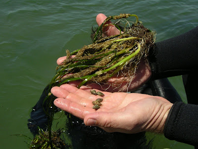
Another interesting aspect of this dive was the grazing community observed. We expect to see mud snails (Ilyanassa obsoleta) and we did see them on the bottom, laying eggs at the base of the leaves and even up on some of the flowers, but it was the other species that caught our attention. What struck me most was the almost total lack of Lacuna vincta and the presence of two other species which we do not see. The most interesting to me is what APPEARS to be the very large and orange Rough Periwinkle (Littorina saxatilis) (see top photo). Although this species is known to frequent grass in areas north of here, we have never seen this species in eelgrass on Long Island. Another interesting occurrence was a small unidentified species that looked very much like Bittium (above left), but we don’t know what this is either. This could also be a species in the Rissoidae family. Kim had seen a similar, if not the same species, in Great South Bay last year in the grass…

Other interesting sightings included isopods, grass shrimp, sea cucumbers (right) and stickle back nests. These are all kind of typical for a protected muddy bottom site like this and Coecles. This just goes to show how productive and diverse this type of meadow can be. All the more reason why we need to protect grass in these areas.

I could go on, but that’s enough about Bullhead. We’ll be sure and check back later in the season to observe seed production and also for our regular PE SAV monitoring in August. Another site where swimmers itch is almost guaranteed in summer…joy!

-ChrisP

Friday, May 9, 2008

Coecles Harbor Natural Meadow Redux


Following up on our first dive of the year in January at Coecles I decided it was just about time to check the status of this interesting meadow we had observed 3 months ago. We are very interested in this site for a couple reasons. First, the Town of Shelter Island may be interested in funding restoration work in town waters and this may be the only candidate site (actually an unvegetated area across the Harbor would be the focus if we were to undertake any work). As part of this, we need to find out the relative contribution of seeds vs. lateral shoot recruitment in meadow maintenance. If seeds are the primary means of meadow maintenance then it would not be a good idea to collect seeds from this site.

Second, and more importantly, we are VERY interested in learning more about the ecology of muddy bottom protected sites like this. Based on recent historic losses, these sites are becoming very rare and if we are to preserve what is left and possibly return grass to other similar areas, we must first understand how these systems function. The more we can learn about how these meadows survive under multiple stressors such as high temps, fine sediments, low light and high bioturbation, the closer we can come to re-establishing grass in other similar areas in the region.

On April 30th we anchored at the same site where we had first observed all of the seedlings in January, luckily this time it was much warmer! Once in the water I was surprised to see the number and size of the reproductive shoots floating above the canopy. On closer inspection the flowers proved to be very large and even the vegetative shoots were taller and had wider blades than I had expected. Even more interesting was the fact that there were many more seedlings than there were adult shoots; even more than I had observed previously. Apparently this meadow really does rely on seedling recruitment for maintenance. It almost appeared to be a case of forced annual expression although it is difficult to say this for sure. We have seen similar things in Noyack Creek and Bullhead Bay.

In some areas there were no adult shoots to be found, only seedlings. In these areas it was a little difficult to distinguish adult shoots form seedlings, but excavating (and replanting!) a few individuals and comparing leaf width with nearby adult shoots made this possible. Seedlings were so dense is some areas it appeared that they were almost chocking each other out. This close proximity appears to also have assisted the spread of wasting disease from neighbor to neighbor as evidenced by the large numbers of infected leaves in these dense patches.

Other interesting observations included the huge number of stickleback nests observed (photo at right), mostly on the taller reproductive shoots. In the past I have seen these nests on natural grass in Noyack Creek and on our plantings in Sag Harbor Cove, but never in the numbers we found in Coecles. It really was amazing. Since it was so long since I had seen a nest I wasn't sure what they were at first and actually poked a little inside one just to see if it had eggs...oops it did! (see above and left) Usually, we see the males (?) guarding the nest, but I didn't. Steve said he did.

Some other points of interest included a couple false angel wing siphons coming up out of the bottom and numerous mantis shrimp burrows (see top photo) that looked like miniature volcanoes. As far as snails, there wasn't an overabundance of mud snails or mud snail eggs, but they did seem to be concentrated in certain areas resulting in lots of eggs on some plants.

I look forward to getting back to Coecles as the season progresses, but I don't look forward to what will likely be a bad case of swimmers itch next time...

-ChrisP

Sag Harbor Test Plots

On April 25th we were able to check out our Sag Harbor test plantings on the east side of North Haven, Southampton. This work is part of our site selection work for the Suffolk County Eelgrass Restoration Initiative. Steve got in and took pictures starting with plot 1 (shallow) and working out to plot 4 (deep). All plants looked excellent once he removed the heavy covering of drifting macroalgae. This covering is typical for this time of year, especially at a site like this where the current runs strong (see photo below) and transports all kinds of floating material to our plots.

We were missing many shoots, probably the result of erosion or, more than likely, from crab burrowing. Shoot densities ranged from 20 in the deepest plot to 120 at the second shallowest plot (we planted 200 shoots per plot last fall). Although plot 1 looked the best in the photo (see above) plot 2 actually had the highest density with 120 shoots remaining.

If these plots are not dug out by burrowing crabs or whelks I am fairly confident that we should have long-term survival here given the presence of grass nearby, but there is no guarantee of this. Over the coming months we will track to progress of these plantings. I doubt plot 3 and 4 will make it through June given our experience with this area in the past...

-ChrisP

Noyack Creek Restoration Work


On April 30th we checked on the status of our seeding effort in Noyack Creek. This project is part of a Peconic Estuary Program Eelgrass Restoration initiative (North Haven Project). Last December Kim, Ali and I broadcast approximately 60,000 seeds (see photo below) in an area on the NE side of the creek where grass most recently occurred. This dive was MY first check on the seedling recruitment here; Steve and Kim had confirmed there were seedlings and deployed a temperature logger on April 17, but I had to see for myself.

I was happy to see that the seedlings were still there and was able to get a few good pics with my hand in the shot for scale. The seedlings were a little smaller than I expected, but they looked good and didn't have too many mud snail eggs attached. As usual the distribution was VERY patchy and there were areas with large numbers of seedlings and areas with no seedlings between the buoys we had set out to mark the site last year.

We will be closely monitoring the seedlings to see how they progress through the spring and into summer. I have concerns that they may die as the water temperature increases and dissolved oxygen levels decrease at the sediment surface at the VERY muddy site. Noyack Creek is a model for other creeks in the Peconic Estuary and if we can figure out how to get the grass re-established here, we might be able to make headway in other similar creeks. We might have to think about manipulating the sediment texture/organic matter.

Stay tuned for some ideas I have about this...

-ChrisP

Thursday, May 8, 2008

The Red Cedar Bluff Restoration Site


On April 23, 2008 Kim and I did a first recon dive of the Red Cedar Bluff restoration site located in western Great Peconic Bay near Squire Pond, Southampton. This one acre transplant site, funded by the Natural Resources Conservation Service, involved planting adult shoots gathered from various Peconic Estuary site in groups of 8-12 on 1m centers throughout the entire site.

The first transplant work at this site was initiated in 2006 when we established multiple 1m circular plots (perpendicular to shore) across the depth contours to target the most appropriate planting depth. Within the first growing season we lost the two shallowest and one of the deeper plots leaving behind two mid-depth stations. Eventually, the shallower of these also succumbed to disturbance from crabs and was lost.

I have to say that it is not unusual to lose most of these plots, or at least the shallow and deep stations as our intention is to push the limits of water depth and light penetration in the deep stations and physical disturbance and exposure in the shallow stations. If we don't lose at least the shallowest and deepest stations than we haven't successfully tested the limits of this site!

Once we got in the water it was nice to see that one of the original plots (see top photo) was still intact and looked very good indicating that water quality is still sufficient here to support grass. Based on the "long-term" (2 yrs.) survival of this initial planting we are fairly confident that the large-scale effort will succeed.

During our dive, we were happy to see that most of the clumped plantings had survived this past winter and appeared to be thriving (above right). A few clumps were missing among the hundreds, but this is not a concern. Mud snails could be seen laying bending over the shoots and laying eggs, but this is typical for this time of year. In another couple weeks the eggs should hatch and there should be few egg cases to be found. As always, we like to see the snails at our sites as they are key to grazing epiphytes off the leaves and maximizing light to the plants.

ChrisP

Wednesday, May 7, 2008

The New York State Seagrass Taskforce

During this spring the NY State Seagrass Taskforce has been meeting to discus issues relating to the mapping, management, restoration and protection of eelgrass in NY waters. For a list of taskforce members, meeting agendas and to view the enabling NYS legislation see the NYS Seagrass Taskforce web page. Laura Stephenson (lbstephe@gw.dec.state.ny.us) from the NYSDEC is responsible for providing all content for this site.

Much of the work of the taskforce is being guided by information gathered at a New York State Seagrass Experts Meeting held on May 22, 2008. See the meeting report here. Recent agenda items for the taskforce have included mapping protocols, research topics, boat mooring alternatives and funding for various projects. See the web page for a link to all agendas, to date.

ChrisP

Robins Island and Hog Neck Bay test plots


On April 17th Steve and Kim headed out to check on the status of several test plots off Great Hog Neck and Robins Island in Southold. These plots were planted out in fall of 2007 and are part of the site selection work underway for the "Suffolk County Eelgrass Restoration Initiative" funded by Suffolk County. Site selection involves conducting test plantings in fall/winter and following the progress of these transplants over the following year. Plots that make it through August are deemed worthy of further planting scale-up, if not full scale (acre size) plantings. We typically plant out a series of 1m diameter (200 shoots each) circular plots perpendicular to shore running from just below MLLW to a depth of about 2m at low tide. In this way we can determine the most appropriate planting depth at each site. Initial site selection is based on historic presence of grass, water quality, fetch and bottom characteristics.

The Hog Neck site (left) had suffered some losses during early winter that we were already aware of so we knew that the shallowest plots would not be intact. The deeper plots (3&4) were found however and the the plants looked excellent. In addition to the circles, Steve had also added some clumped plantings (see below) in early winter to see how these would fair compared to the circular plots. These also looked good. There was lots of brown drift algae attached to the shoots, but this is to be expected during this time of year when the water is still cold.

The Robins Island plots probably looked better than we have EVER seen for overwinter survival and health in eelgrass in the Peconic Estuary. All plots were intact and the density was very good, especially for the two shallower plots (see "RI2" in top photo). Shoot densities ranged from a low of 181 to a high of 217 with the two shallower plots coming in over 200, actually adding shoots overwinter. It is interesting to note that you can see that plot #2 had lost about 2-4cm of sand just recently (within the week?). If you look close you can see the white sheaths and roots at the base of the plants. These would not normally visible.

As the season progresses we will follow these plots closely to see how they fair in response to lower water clarity and higher water temperatures.

ChrisP